Trips Places Foods Stories Newsletters
Loading...
Loading...
Loading...
Loading...

No search results found for
“”

Make sure words are spelled correctly.

Try searching for a travel destination.

Places near me Random place

Popular Destinations

  • Paris
  • London
  • New York
  • Berlin
  • Rome
  • Los Angeles
Trips Places Foods Stories Newsletters
Sign In Join
Places near me Random place
All the United States Kansas Ransom Cedar Bluff Reservoir
AO Edited

Cedar Bluff Reservoir

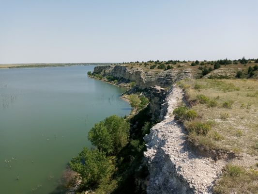
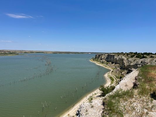
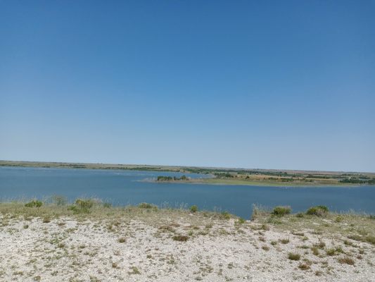
This 100-foot tall bluff located in the western plains of Kansas overlooks a massive reservoir.

Ransom, Kansas

Added By
Prairie Rambler
Email
Been Here
Want to go
Added to list
CAPTION
View to the east.   Prairie Rambler / Atlas Obscura User
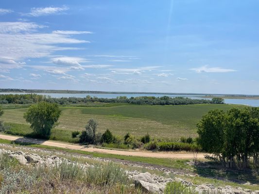
View to the west.   Prairie Rambler / Atlas Obscura User
Cedar Bluff Reservoir   Prairie Rambler / Atlas Obscura User
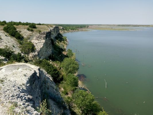
View to the north.   Prairie Rambler / Atlas Obscura User
Been Here
Want to go
Added to list

About

A hidden gem of geology nestled in the Smoky Hill River Valley, Cedar Bluff offers unparalleled views of the lake and surrounding countryside. It was formed by years of erosion along what was once the floor of the Great Interior Seaway, that once stretched from the Gulf of Mexico to the Arctic Circle. The sandy seafloor turned to limestone and has been eroded over the millennia by wind and water. The Smoky Hill river is the root cause of this bluff. 

Atop the bluff, visitors can see for miles in all directions and can walk right to the edge of the bluff. It's quite the drop to the shoreline below.

The state park nearby offers excellent camping, both for RVs and tents alike, whether for group or solo excursions. Despite being located in western Kansas, there are ample shade trees around the reservoir. There are also several outdoor sporting opportunities around the reservoir.

Related Tags

Geology Natural Wonders Natural History Nature

Know Before You Go

There is a small circle turnaround at the top of the bluff for parking. The walk to the edge of the bluff is very short and possibly accessible by wheelchair, though nothing about it is ADA acceptable. 

Access off I-70 is quick. Take State Highway 283 South 22 miles to AA road and turn east. Travel a few miles and turn north on 290th Ave. Continue north until the road splits. Toward the left is a small day-use area, to the right and up the hill leads to the bluffs. Alternatively, take 147 South across the dam, and access the bluffs through the state park. AA and 290th are dirt roads and are sloppy after rainstorms. They are otherwise smooth. 

Be careful on the edge of the bluff, as the ground can be loose in areas. 

Community Contributors

Added By

Prairie Rambler

Edited By

jpfeifer14, dbjwjbkrvk

  • jpfeifer14
  • dbjwjbkrvk

Published

October 2, 2020

Edit this listing

Make an Edit
Add Photos
Cedar Bluff Reservoir
Unnamed Road
Ransom, Kansas, 67572
United States
38.791679, -99.878176
Get Directions

Nearby Places

WaKeeney North Pole

WaKeeney, Kansas

miles away

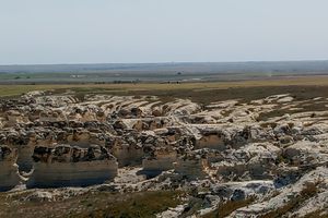
Castle Rock Badlands

Quinter, Kansas

miles away

The Original Boot Hill Cemetery

Hays, Kansas

miles away

Explore the Destination Guide

Photo of Kansas

Kansas

United States

Places 126
Stories 11

Nearby Places

WaKeeney North Pole

WaKeeney, Kansas

miles away

Castle Rock Badlands

Quinter, Kansas

miles away

The Original Boot Hill Cemetery

Hays, Kansas

miles away

Explore the Destination Guide

Photo of Kansas

Kansas

United States

Places 126
Stories 11

Related Stories and Lists

The United States of Camping

List

By Michelle Cassidy

Related Places

  • Winona, Missouri

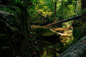
    Rocky Falls

    A 40-foot waterfall flows into this unique natural swimming hole.

  • Aerial view of High Rock Canyon.

    Gerlach, Nevada

    High Rock Canyon Wilderness

    Many generations of travelers have passed through the steep, smooth walls of this canyon.

  • Al Wathba Fossil Dune Formations

    Abu Dhabi, United Arab Emirates

    Al Wathba Fossil Dunes

    These otherworldly formations were shaped over millions of years by the forces of nature.

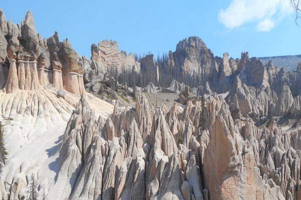
  • Wheeler Geologic Area

    Creede, Colorado

    Wheeler Geologic Area

    This once-popular otherworldly landscape was formed by one of the largest volcanic eruptions in history.

  • Prästens Badkar (The Priests Bathtub)

    Simrishamn, Sweden

    Prästens Badkar (The Priests Bathtub)

    The world's only above water sand volcano, believed to once be the bathtub of a priest.

  • The sign for the iridium layer, located next to the exposed rock.

    Raton, New Mexico

    Raton Iridium Layer

    This unassuming layer of clay boasts an out-of-this-world origin story.

  • Mobius Arch

    Lone Pine, California

    Mobius Arch

    This rock formation named for its unique shape is one of many that call the Alabama Hills home.

  • Las Cruces, New Mexico

    Prehistoric Trackways National Monument

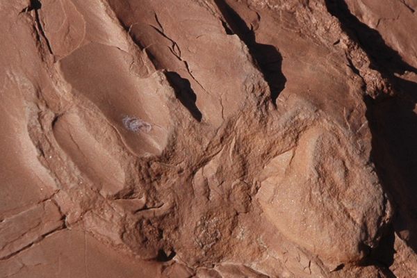
    Wee (and not so wee) footprints that insects and reptiles of the Paleozoic Era left behind.

Aerial image of Vietnam, displaying the picturesque rice terraces, characterized by their layered, verdant fields.
Atlas Obscura Membership

Become an Atlas Obscura Member


Join our community of curious explorers.

Become a Member

Get Our Email Newsletter

Follow Us

Facebook YouTube TikTok Instagram Pinterest RSS Feed

Get the app

Download the App
Download on the Apple App Store Get it on Google Play
  • All Places
  • Latest Places
  • Most Popular
  • Places to Eat
  • Random
  • Nearby
  • Add a Place
  • Stories
  • Food & Drink
  • Itineraries
  • Lists
  • Video
  • Podcast
  • Newsletters
  • All Trips
  • Family Trip
  • Food & Drink
  • History & Culture
  • Wildlife & Nature
  • FAQ
  • Membership
  • Feedback & Ideas
  • Community Guidelines
  • Product Blog
  • Unique Gifts
  • Work With Us
  • About
  • FAQ
  • Advertise With Us
  • Advertising Guidelines
  • Privacy Policy
  • Cookie Policy
  • Terms of Use
Atlas Obscura

© 2025 Atlas Obscura. All Rights Reserved.